
What is Larkya La? (the short answer)
Larkya La, also written Larke La, Larkya Pass or Larke Pass, is a 5,106 m (16,752 ft) mountain pass in central Nepal, on the Manaslu Circuit, linking the Budhi Gandaki valley in Gorkha district with the Dudh Khola and the head of the Marsyangdi in Manang district. It is the highest point of the trek and the only way out of the upper Budhi Gandaki on foot other than the way you came in.
It is not the highest pass on a Nepali teahouse route. Thorong La on the Annapurna Circuit is 310 m higher, and both are beaten by passes on the Three Passes and Great Himalaya routes. What Larkya La has instead is the longest and most committing pass day of the mainstream teahouse treks: roughly 24 km, 8 to 10 hours, a 1,386 m descent on the far side, and no road within two days in either direction. Height is not what makes this one serious. Length, remoteness and the descent are.
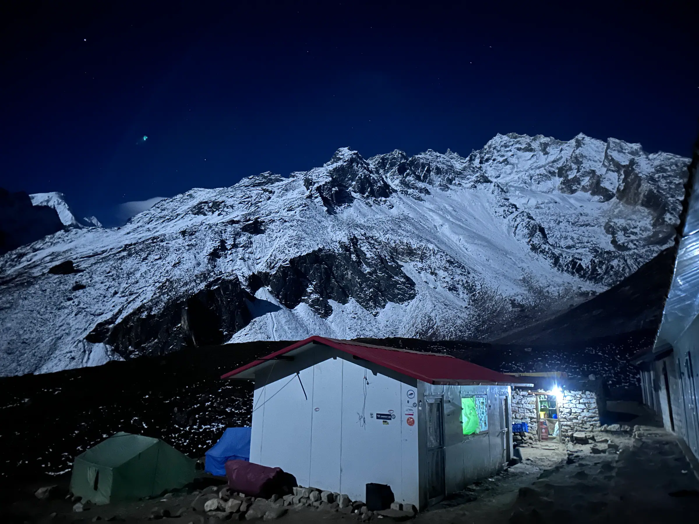
You cross it on one long day from Dharamsala, also called Larkya Phedi, at 4,460 m, starting in the dark, and finish at Bimthang (3,720 m) in the afternoon or early evening. There is no camping on the pass and no shelter on it. Once you are more than an hour past Dharamsala, going forward is almost always faster than going back.
Larkya La facts at a glance
| Elevation | 5,106 m / 16,752 ft |
|---|---|
| Also written | Larke La, Larkya Pass, Larke Pass |
| Location | Between Gorkha and Manang districts, Gandaki Province, Nepal |
| Approximate coordinates | 28.67° N, 84.53° E |
| Connects | Budhi Gandaki valley (east) ↔ Dudh Khola and Marsyangdi (west) |
| Approach from | Dharamsala / Larkya Phedi, 4,460 m |
| Descends to | Bimthang 3,720 m |
| Ascent on crossing day | +646 m from Dharamsala |
| Descent on crossing day | −1,386 m |
| Distance on crossing day | ~24 km |
| Typical time | 8–10 hours moving |
| Technical difficulty | None in normal autumn conditions: a walk, not a climb. Microspikes are occasionally useful on the descent in spring |
| Reliable crossing seasons | Late March to mid-May · late September to late November |
| Temperature at the pass, dawn | −5 °C to −15 °C in peak season; colder with wind chill |
| Nearest road | Roughly two days' walk on either side |
Everything above is the easy part. The rest of this page is the part that matters.
The Larkya La crossing day, hour by hour
This is the day people book the Manaslu Circuit for and the day they most misjudge. It is not technically hard. It is very long, cold, high and unforgiving of a bad night's sleep, and unlike most pass days the second half is harder than the first.
The night before, at Dharamsala (4,460 m)
You arrive early afternoon after a short three-hour day from Samdo, on purpose. Dharamsala is not a village: it is a handful of stone and tin buildings on open ground, with a limited number of beds, a limited menu, no shop, no clinic and, in a busy autumn, more trekkers than mattresses. Eat properly, drink far more than you want to, and get your kit laid out before dark: nothing is worse than hunting for a head torch at 03:15 at minus ten. Most people sleep badly at 4,460 m. Expect that, and do not panic about it.
03:30–04:30, start
Breakfast is porridge and tea in the dark. You set off by head torch, in every layer you own, and you will be too hot within twenty minutes and too cold every time you stop. The early start is not machismo, and it is not really about the wind either: it is about having the whole descent done in daylight. A group that leaves at 06:00 is finishing a 1,386 m descent on tired legs with head torches on.
04:30–09:00, the climb
The trail climbs steadily onto lateral moraine and then along it, past a string of frozen tarns, with the Larkya glacier on your left. It is not steep. It is relentless, and it is at altitude, and there is a run of false tops near the end, each of which looks like the pass and none of which is. Four to five hours at the slowest pace you have ever kept. Assume no tea shack, because there is not one. This is where altitude bites: if anyone in the group is going to feel really unwell, it shows here, above 4,800 m, in the cold and the half-dark.
09:00–09:30, the pass
A broad, stony saddle, a cairn and a mass of prayer flags at 5,106 m. To the west the view opens onto Himlung Himal, Cheo Himal, Gyaji Kang and Kang Guru, and on a clear day the Annapurnas beyond. Behind you is the whole Budhi Gandaki. Do not linger.Fifteen or twenty minutes for photographs and a hot drink from a flask, then down. Standing about at 5,106 m in wind chill is how people get cold injuries and how mild altitude symptoms become serious ones, and you still have most of the day's work in front of you.
09:30–15:00, the descent to Bimthang
This is the part nobody warns you about, and on this trek it is genuinely the crux. From the pass it is 1,386 m of descent over about 12 km. The first section is the awkward one: steep, loose moraine that holds old snow and ice well into the spring and occasionally has a fixed line on it. Then a long traverse above the Salpudanda glacier, and finally a knee-punishing drop into the meadows above Bimthang. Four hours or more, and it is where most of the twisted ankles and blown knees on this trek happen, because people relax after the summit photo and stop concentrating. Trekking poles are not optional on this descent.
Arrival at Bimthang (3,720 m)
A meadow of yak pasture and old stone huts, ringed by Manaslu's western glaciers, with warm rooms and, for many trekkers, the best night's sleep of the trip, nearly 750 m lower than the night before. Look back up at the pass in the evening light. It looks a very long way away, because it is.
| 03:15 | Wake, breakfast, final kit check at Dharamsala |
| 04:00 | Depart by head torch, −5 to −15 °C |
| 06:30 | First light on the moraine; usually the coldest hour of the day |
| 09:00–09:30 | Larkya La, 5,106 m: 15–20 minutes maximum |
| 11:30 | Below the steep moraine section; the gradient eases |
| 14:00–15:00 | Bimthang, 3,720 m |
Why Larkya La is genuinely serious
Most operators describe the pass as "challenging but rewarding" and move on. We would rather set out the hazards properly, because a trekker who understands them is a trekker who turns back at the right moment.
1. Altitude: 5,106 m is very high
At the pass, barometric pressure is a little over half that at sea level, so each breath delivers roughly half the oxygen. The risk of acute mountain sickness rises sharply with altitude and with speed of ascent, and the two serious forms, high-altitude pulmonary oedema (HAPE) and high-altitude cerebral oedema (HACE), become real possibilities above 4,500 m in poorly acclimatised people. The Wilderness Medical Society clinical practice guidelines for acute altitude illness are the standard reference here, and their central recommendation above 3,000 m is unglamorous: raise your sleeping altitude by no more than about 500 m a day, with a rest day roughly every 1,000 m. The circuit's Samagaun rest day exists precisely to satisfy that rule. Full detail in our Manaslu Circuit altitude sickness guide.
2. Remoteness: the Manaslu-specific hazard
This is the difference between Larkya La and a higher pass on a busier trail, and it deserves more weight than its height does. On the near side, the last village is Samdo, three to four hours below Dharamsala. On the far side, the first village is Bimthang, on the other side of the pass. Dharamsala itself has no clinic, no shop and no road. A trekker who becomes seriously unwell there has two options: walk down, or wait for a helicopter that only flies in good weather and good light. Everything else on this page follows from that.
3. Weather and whiteout
Larkya La is a broad saddle rather than a narrow notch, which is pleasant in good visibility and a problem in bad. In a whiteout the line across the upper section is not obvious, and there is no shelter at all between Dharamsala and the far side of the descent. The pass does not need a full storm to become serious; it needs a couple of hours of driving snow and poor visibility, and autumn cloud can build from mid-morning even in a settled week.
4. Cold and wind chill
Dawn temperatures at the pass in October and November typically sit between −5 °C and −15 °C, and a 40 km/h wind takes the effective temperature far lower. Frostbite here is almost always fingers, toes, nose and ears, and almost always follows the same pattern: thin gloves, a stop for photographs, wet socks from the previous day, or a hand out of a mitt to work a camera. The cold-weather kit list for this specific day is on the Manaslu Circuit packing list.
5. The descent trap
The pass is only a third of the day. People celebrate at the cairn, then face four or five hours of steep, loose, sometimes icy descent with tired legs, low blood sugar and dwindling concentration, over a bigger vertical drop than the Thorong La descent. Ankle and knee injuries on the Bimthang side are the most common reason a Manaslu trip needs outside help. Eat at the pass, use poles, and treat the descent as the second half of the day rather than the way home.
Our Larkya La safety protocol
What we actually do, rather than what we say in a brochure. This is the same protocol on every departure, whatever the group has paid.
- A non-negotiable acclimatisation day at Samagaun (3,530 m). Every itinerary we sell includes it, with a climb-high walk to Birendra Lake, Pungyen Gompa or Manaslu Base Camp depending on how the group is going. We will not sell a circuit that skips it.
- A short day into Samdo, and a short day into Dharamsala. Both are three to four hours by design, so that you arrive with the afternoon in hand to eat, drink and rest rather than arriving at dusk already depleted.
- Daily pulse oximetry above 3,000 m. Your guide records oxygen saturation and resting pulse each morning and evening. A single low reading means little; a downward trend across two days means we change the plan.
- A weather decision at Samdo, and again the evening before. Your guide checks the forecast, and talks to the lodge keepers and to the guides coming the other way over the pass, who know more than any app about what it did yesterday.
- An agreed turn-around time.If the group is not at the pass by roughly 10:00, we turn back to Dharamsala. This is stated to everyone the night before, so it is never a negotiation at 4,900 m in the wind.
- The group stays together. No one walks the pass section alone, ahead or behind. Where a group splits by pace we run two guides, and an assistant guide stays with the slowest walker for the whole descent, which is the part where being alone actually matters.
- Supplementary oxygen and a first-aid kit on the pass section. Carried from Samagaun onwards, alongside a pulse oximeter. Oxygen buys time to descend; it is not a reason to keep climbing.
- Descent is always the answer. If a trekker has symptoms of HACE or HAPE, we go down immediately, at night if necessary, and we do not wait for a helicopter to decide for us. From Dharamsala that means back down towards Samdo and Samagaun, not over the pass.
- An evacuation plan before you leave Samagaun. Samagaun has the most usable landing ground on the route and is where an evacuation would normally stage from. Your insurance details and emergency contacts are with the guide and in our Pokhara office, and helicopter evacuation is arranged through our office 24 hours a day.
Our guides are Nepal government-licensed, and on a restricted-area route that is a legal requirement rather than a selling point. Rohit Timilsina, our co-founder, holds licence #1497, and the wider team includes Bishal Baral (#1751), Karuna Acharya (#5213) and Hem Dhoj Waiba (#13854). You will be told your guide's name and licence number before you fly.
The acclimatisation you need before Larkya La
Almost every serious altitude problem on the circuit can be traced back to what happened in the four days before the pass, not on the pass itself. This is the ascent ladder we use, and why it is shaped this way.
| Night | Sleep at | Gain | What it is doing for you |
|---|---|---|---|
| Namrung | 2,630 m | +770 m | Below the threshold where the 500 m rule really bites |
| Lho | 3,180 m | +550 m | First night that feels high |
| Samagaun | 3,530 m | +350 m | Deliberately small gain, and a short day, before the rest day |
| Samagaun rest day | 3,530 m | 0 m | Climb high to 3,900–4,800 m, sleep low. The single most valuable day of the trek |
| Samdo | 3,875 m | +345 m | Well inside the guideline, and the last village before the pass |
| Dharamsala | 4,460 m | +585 m | Above the guideline, the one aggressive night, and why the rest day matters |
| Larkya La (crossed) | 5,106 m | +646 m | Touched, not slept at. Down to 3,720 m the same day |
Two honest notes on that table. First, the Samdo to Dharamsala gain of 585 m exceeds the usual 500 m guideline, and there is no way around it. There is nothing to sleep in between. That is why the Samagaun rest day is compulsory. Second, the ladder below the pass is genuinely gentler than the Annapurna Circuit equivalent, which is the one respect in which Manaslu is the kinder trek: the walk in is long enough that your body has ten days rather than seven to do the work.
The full ascent profile, with the elevation graph, is on the Manaslu Circuit map and altitude profile. The 16-day version of the trip adds a second acclimatisation night at Samdo, with the walk towards the Rui La on the Tibetan border at 4,998 m, which is the best acclimatisation available anywhere on this route, and a full day from Samagaun up to Manaslu Base Camp at 4,800 m. See the 16-day itinerary with Base Camp and the side trips.
When NOT to cross Larkya La
There is no shame in this list and we would rather you read it now than argue about it at Dharamsala.
- If anyone in the party has symptoms of altitude illness.A headache that will not clear with fluids and paracetamol, vomiting, breathlessness at rest, a wet cough, unsteadiness on the feet: any of these means down, not over. There is no scenario in which crossing a 5,106 m pass improves altitude sickness, and on this route "over" means eight more hours before the next bed.
- If the forecast is bad or the pass turned people back yesterday. Waiting a day costs one day, and the 14-day itinerary carries a buffer for exactly this. It is the cheapest insurance on the trek.
- In fresh deep snow, without local advice. After heavy snowfall the upper section can be waist-deep and unmarked, and the moraine on the descent becomes the real problem rather than the climb. Lodge keepers and the guides coming the other way know when it has been broken; we ask them.
- In mid-winter, on a first Himalayan trek.December to February the pass is usually impassable, and the Dharamsala huts close, which removes the only shelter on the near side. It is crossable by experienced, properly equipped parties in a settled spell. It is not a first-timer's proposition.
- If you are not at the pass by the turn-around time.Late on the pass means late on a 1,386 m descent, in wind, possibly in the dark, with a tired group. This is the specific failure mode that ends in a stretcher on the Bimthang side.
- If your gut says no. Guides listen to this more than trekkers expect. If you want to stop, say so.
The alternative if you cannot cross is not the end of your trip, but it is a longer retreat than on the Annapurna Circuit and you should know that before you start: from Dharamsala you retrace the valley to the roadhead over three or four days. There is no jeep at Samdo. Helicopter evacuation exists for medical emergencies, not for schedules.
Larkya La through the seasons
| Season | Pass conditions | Dawn temperature | Verdict |
|---|---|---|---|
| Spring (late Mar to mid-May) | Usually open from late March; significant residual snow on the descent early in the season, softening later | −5 to −12 °C | Very good, warmer and far quieter than autumn, hazier views. Carry microspikes in March and early April |
| Monsoon (Jun to mid-Sep) | Sometimes crossable, but the Budhi Gandaki gorge approach is the real objection: landslides, washed-out bridges and leeches | 0 to −5 °C | We do not run it |
| Autumn (late Sep to Nov) | The most reliable window of the year | −5 to −15 °C | Best. Book early: Dharamsala's beds are the bottleneck |
| Winter (Dec to Feb) | Usually impassable after snowfall; the Dharamsala huts close and the upper teahouses empty out | −15 to −25 °C | Experienced parties only |
Note that nobody officially "closes" Larkya La. There is no barrier and no permit that gets withdrawn. It simply becomes impassable, and whether it is passable on a given morning is a judgement made by the guides and lodge keepers at Dharamsala. Month-by-month weather is on our best time to trek the Manaslu Circuit page.
Fitness and pace for the crossing day
Fitness will not protect you from altitude illness (that is a separate physiological lottery), but it changes everything else about the day. A fit trekker walks the pass at a comfortable, sustainable, slow pace, arrives at the cairn with reserves, and still has legs for the descent. An unfit trekker arrives empty and then has to do the hardest five hours of the trek.
The honest benchmark: if you can walk eight hours in the British hills with a 5 kg pack, two days running, and feel fine on the third morning, you have the base you need. That is a step up from what the Annapurna Circuit asks, and it is deliberate. Add hill repeats and, above all, long descents to your training: Larkya La punishes quadriceps far more than it punishes lungs, and 1,386 m down in one go is more than Ben Nevis from the summit to the sea. Our difficulty and fitness guide has the eight-week plan.
On the day itself, the rule is slower than feels natural. Your guide will set a pace that seems absurd for the first hour. Match it. Trekkers who go out fast from Dharamsala are the ones sitting down at 4,900 m.
Insurance for Larkya La: the altitude and remoteness problem
This is where UK trekkers get caught. Most standard and annual multi-trip travel policies cap trekking cover somewhere between 2,000 m and 4,000 m, which means they would not respond to an incident on Larkya La at all. You need a policy that names an altitude limit at or above 6,000 m and states helicopter search and rescue explicitly.
There is a second thing to check that does not arise on the Annapurna Circuit: some policies exclude remote or restricted areas, or require that you are with a licensed guide, which on this trek you always are. Read the exclusions, not just the altitude band.
| Provider | Cover type | What to check in the wording |
|---|---|---|
| BMC (British Mountaineering Council) | Trek and Alpine policies used widely by UK hillwalkers | The altitude band you select covers 6,000 m |
| True Traveller | Adventure pack add-on | Trekking altitude limit and helicopter rescue both named |
| Snowcard | Specialist mountain activity cover | Activity band matches "trekking to 6,000 m" |
| World Nomads (UK) | Plan-dependent adventure cover | Altitude limit on your specific plan, not the marketing page |
A helicopter rescue from the upper Budhi Gandaki runs to several thousand pounds and is billed to you or your insurer, not to us. Buy the policy before you fly from the UK: no insurer will cover an incident already under way. Permit and paperwork requirements are on the permits page.
Larkya La and the Manaslu region: the honest record
We publish this because a safety page that omits it is not a safety page, and because a search for "Manaslu deaths" returns two events that are nothing to do with the trekking route. Both are worth knowing about, and neither should be used to judge the circuit.
The 2012 avalanche was a mountaineering accident, not a trekking one
On 23 September 2012an avalanche struck an expedition camp high on Manaslu itself, killing eleven climbers. That was a serac collapse at around 6,800 m on the standard climbing route to the summit, on the mountain, in the mountaineering season. The trekking circuit does not go anywhere near it. If you read a headline about Manaslu deaths and it involves Camp 3, it is describing a different activity.
The 2015 Gorkha earthquake hit this valley hard
The 25 April 2015 earthquake had its epicentre in Gorkha district, which is the district this trek walks through. Villages along the Budhi Gandaki suffered serious damage and loss of life, trails and bridges were destroyed, and the route was effectively closed for a season. It has since been rebuilt, and the lodges you will stay in at Namrung, Lho and Samagaun are largely post-earthquake construction, which is one reason they are in better condition than their age suggests. It is also a reason the villages take the trekking economy seriously: it paid for a lot of the rebuilding.
On the pass itself
There is no official public register of trekking fatalities in Nepal broken down by pass, so we do not quote an annual figure for Larkya La. We would only be making one up. What is consistently reported, and what matches what our guides see, is that the recurring causes are the ones this page has spent two thousand words on: altitude illness in trekkers who ascended too fast, exposure in bad weather on a broad pass with no shelter, and injuries on the long descent to Bimthang. The unseasonal October 2014 storm that killed more than forty people in the Nepal Himalaya, mostly in the Annapurna region, is the standing reminder that a settled autumn forecast is not a guarantee.
All three causes are reduced by the same unglamorous things: acclimatising properly, starting early, checking the weather with people who were on the pass yesterday, and being willing to lose a day. On a route with no road, that last one costs more and matters more.
How we source and check the safety claims on this site is set out in our editorial policy.
Safety question about the pass? Message us directly: +977 9704551232